
SUISS Poseidon

The SUISS-Poseidon (SUISS = Swiss Underwater Information Supervision Software) allows the systematical categorization and management of the measurement data: it is the link to your own geographical information system.

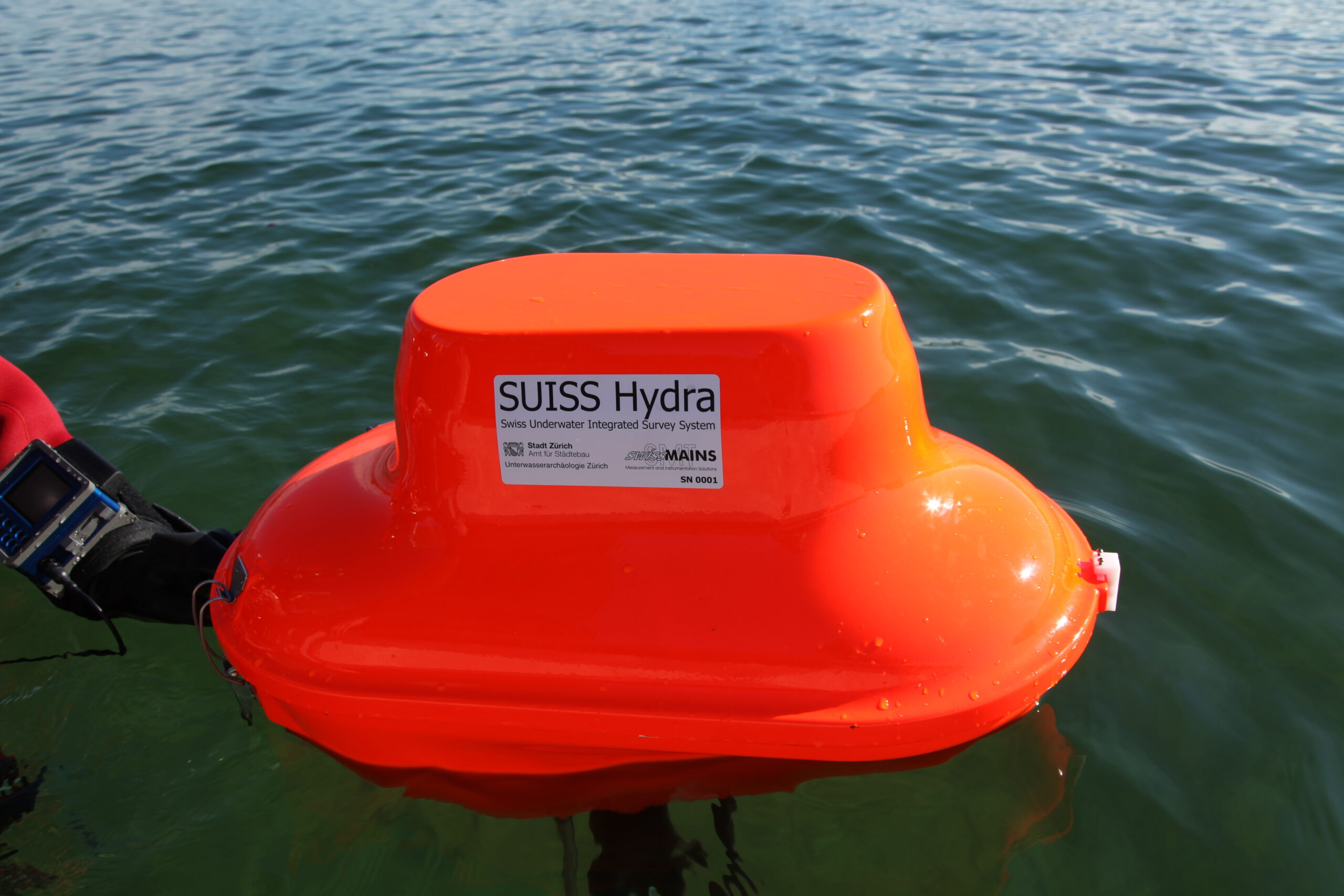
The aim of the development of SUISS Hydra was the modernization of surveying in underwater archaeology State-of-the-art technology and most sensitive sensors allow for very accurate measurements in great depth in fresh water. Thanks to highly integrated circuits the hand set is small and handy.

The System was developed with the following applications in mind:
– Setting up of a survey grid
– Recording of individual findings
– Attribution of each single measurement
– Recording of lines
– Recording of areas
– Delivery of digital elevation models
– Mapping and monitoring of changes
– Also for land-based surveying thanks to a modulare design
We are sure you will find additional applications in your specific area. Let
the technology support your day-to-day operations.
- Flyer of the Hydra
- Suiss-underwater-Website
- Official Website of Zürich, submarine archeology
- SUISS Hydra, article “GPS-gestützte Vermessung in der Unterwasserarchäologie (de)
- SUISS Hydra & SUISS Hermes, publication “graben & auswerten” (de)
- SUISS Hydra & SUISS Hermes, publication “forschen & schützen” (de)
- Publication “verstehen & vorausschauen” (de)